
Osprean prevention
Getting ahead before it happens
The prevention module brings together everything a municipality needs to prepare before an emergency: knowing what resources it has, keeping action plans live and up to date, inspecting the territory regularly and simulating risk scenarios to decide where to act first.
- Web
- Mobile
Inventory to prevent
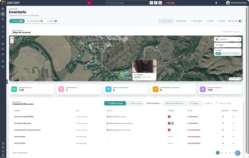
Captures and assesses the condition of the municipality's resources and risks: hydrants, vehicles, staff, logistics, vulnerabilities and hazards, geolocated on the map. You cannot plan with what you don't know you have.
- Web
- Tablet
- Mobile
Emergency action plans
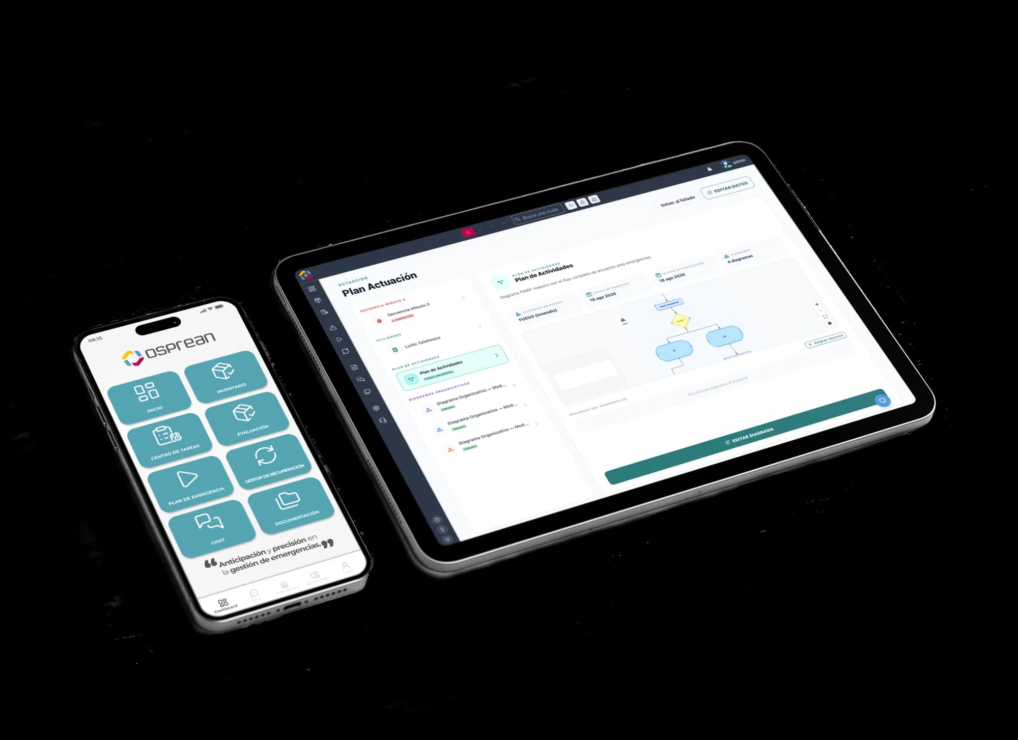
From a paper document to a personalised, operational action plan. Osprean digitises municipal plans (PAMIF, PAMIN, PEMU) with their activity plan, organisation charts and decision diagrams, accessible from computer, tablet or mobile.
- Tablet
- Mobile
Inspection plans: Gemba Walks
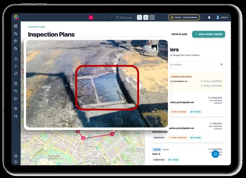
“Gemba” means going to see where the action happens. Gemba walks organise regular inspections of the territory, with routes, tasks and photos, to check every resource is available before it is needed. If you don't know what you have, you can't save it.
- Web
- Mobile
Private estate compliance: clearing required and proven
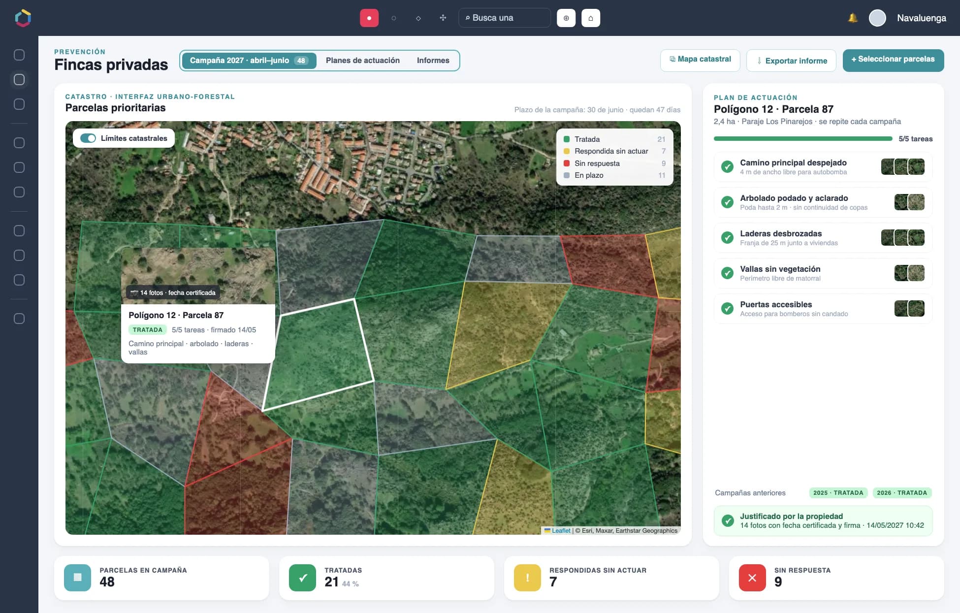
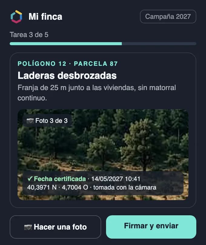
Most of Spain's woodland is privately owned and, until now, the town council could only ask by letter for the land to be cleared. Osprean turns that letter into a task with a deadline: the municipality picks the priority plots on the cadastral map and assigns them an annual action plan focused on what firefighters need. The owner proves it from their phone with photos carrying a certified date and signature, and the map shows which plots have been treated and which have not.
- Web
Wildfire simulator
Analyse, simulate and adapt the fuel. The simulator projects how a wildfire would spread according to terrain, vegetation and weather, and compares scenarios with and without preventive measures such as firebreaks or fuel treatments.
- Web
Torrential rain simulator
Models heavy rainfall even in traditionally arid areas and calculates the water level each point of the territory would reach, to identify vulnerable areas before they flood.
Municipal watchtower drones
Drones that take off from an autonomous base, powered by the grid or solar panels and connected via 4G or satellite, and patrol the territory on a schedule, day and night. They detect smoke automatically by combining RGB and thermal cameras with artificial intelligence, and each alert arrives with a photo and location so the team can verify it and notify firefighting services. If there is a fire, they update the spread prediction on every flight; if there is none, they map fuel and vegetation, and after a fire they track how the burned land recovers.
Frequently asked questions
Which action plans can Osprean digitise?
Municipal civil protection plans such as the PAMIF (wildfires), PAMIN (floods) and PEMU (municipal emergency plan), with their activity plan, organisation chart and action diagrams.
What is a Gemba Walk?
An on-the-ground inspection, where the action happens. In Osprean it is organised as a recurring inspection plan, with routes, tasks and a photo record of every resource.
How does Osprean predict wildfire spread?
It combines the fuel model (vegetation type), terrain and weather conditions to project how the fire would advance, and can simulate the effect of preventive measures.
How do watchtower drones work?
They patrol from a fixed base, analyse images with RGB and thermal cameras and artificial intelligence and, if they detect smoke, send an instant alert with photo and coordinates.
How can a town council require and verify the clearing of a private estate?
With Osprean prevention, the council sends the owner clearing tasks with a deadline, based on a plan for each cadastral plot. The owner proves them with photos taken on the spot from the camera, with a certified date and signature, and the map shows which plots have been treated, which have not responded and which have responded without taking action.
Get your municipality ready before the next season
Request a demo or a territorial preparedness assessment for your municipality.