
Osprean coordination
The whole chain of command, coordinated in real time
When an emergency is declared, Osprean automatically activates each person in charge according to the defined organisation chart and brings the whole team together in the Virtual Emergency Centre: a digital command post where everyone works in sync on the same information, with access based on each person's permission level.
- Web
Virtual Emergency Centre
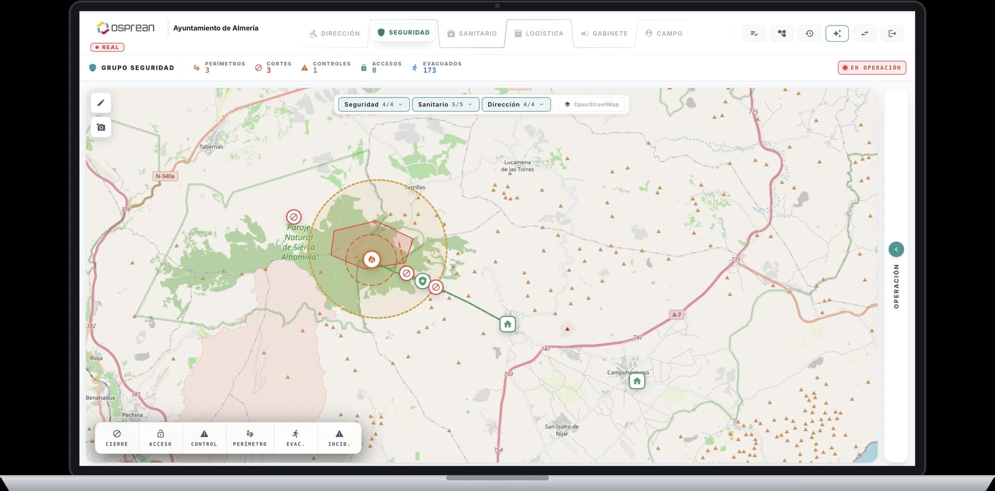
The CECOPAL (municipal operational coordination centre) in digital form. Each response group (command, security, health, logistics, communications and field) has its own panel on a shared operational map: perimeters, road closures, access controls, evacuation routes and reception points, with counters updated instantly. The whole command post sees the same situation, at the same time.
- Web
Minute-zero sequence
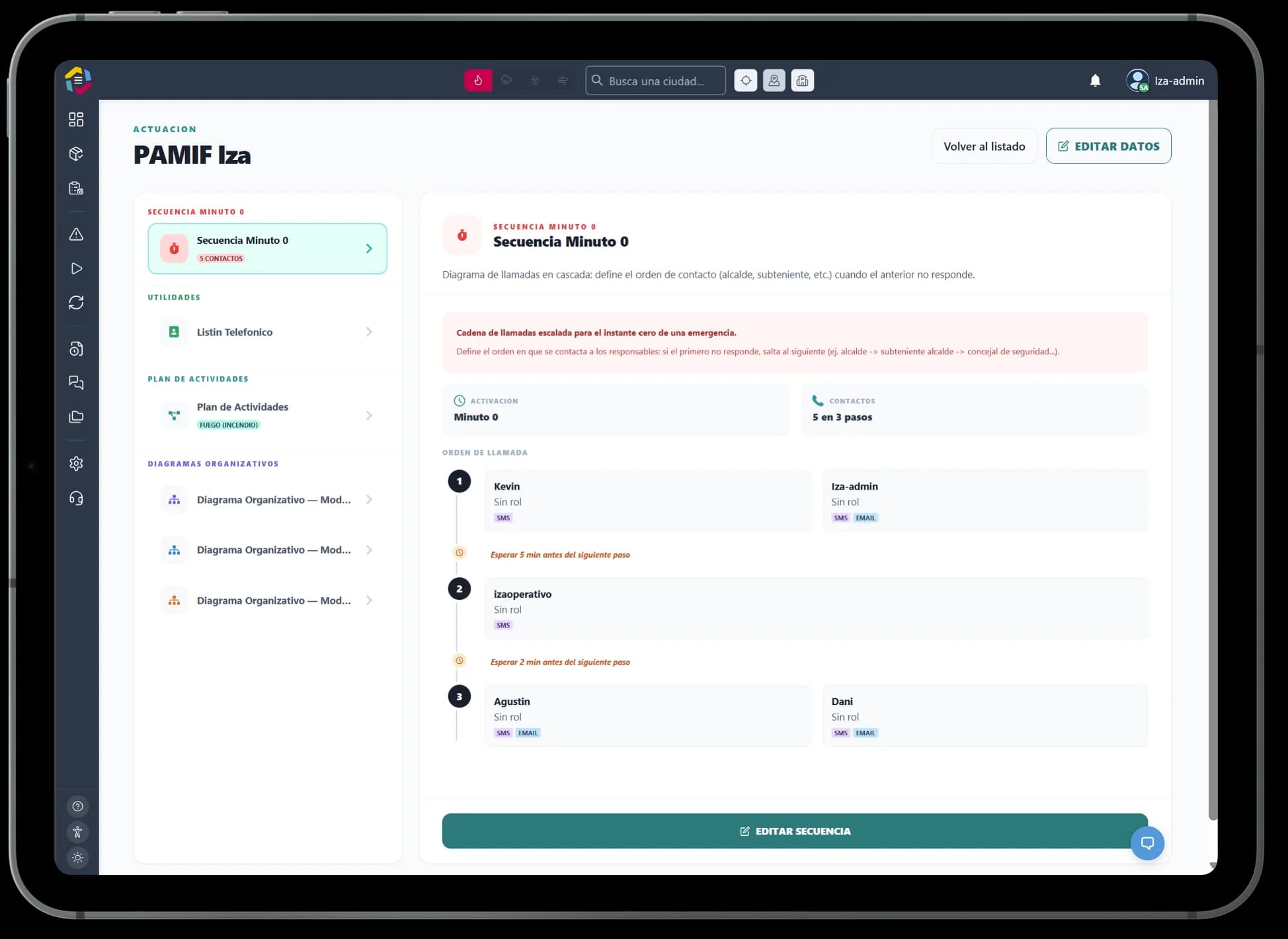
An escalating call chain for the very first moment of the emergency: it sets the order in which each person in charge is contacted by SMS or email and, if someone does not respond, automatically moves on to the next.
- Web
- App
Task Centre: from plan to action in seconds
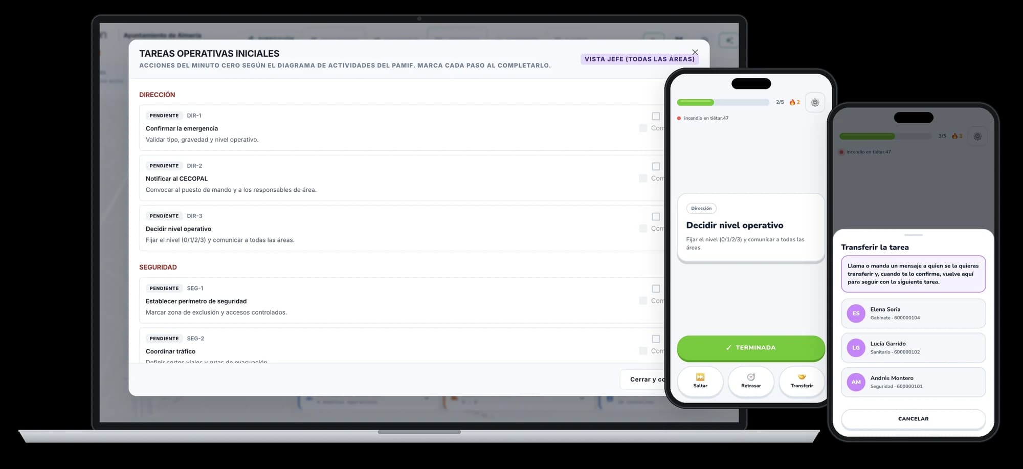
When the emergency is activated, the Virtual Emergency Centre rolls out the minute-zero tasks from the action plan (PAMIF, PAMIN, PEMU), organised by area: command, security, health, logistics. The head of the operation sees progress across every area at a glance. Each person in charge receives their tasks in a fast-action mobile app, one card at a time: mark it done, skip it, postpone it or hand it over to someone else with a single tap. Nobody wonders what to do or who does it.
- Mobile
Eyes on the ground, in real time
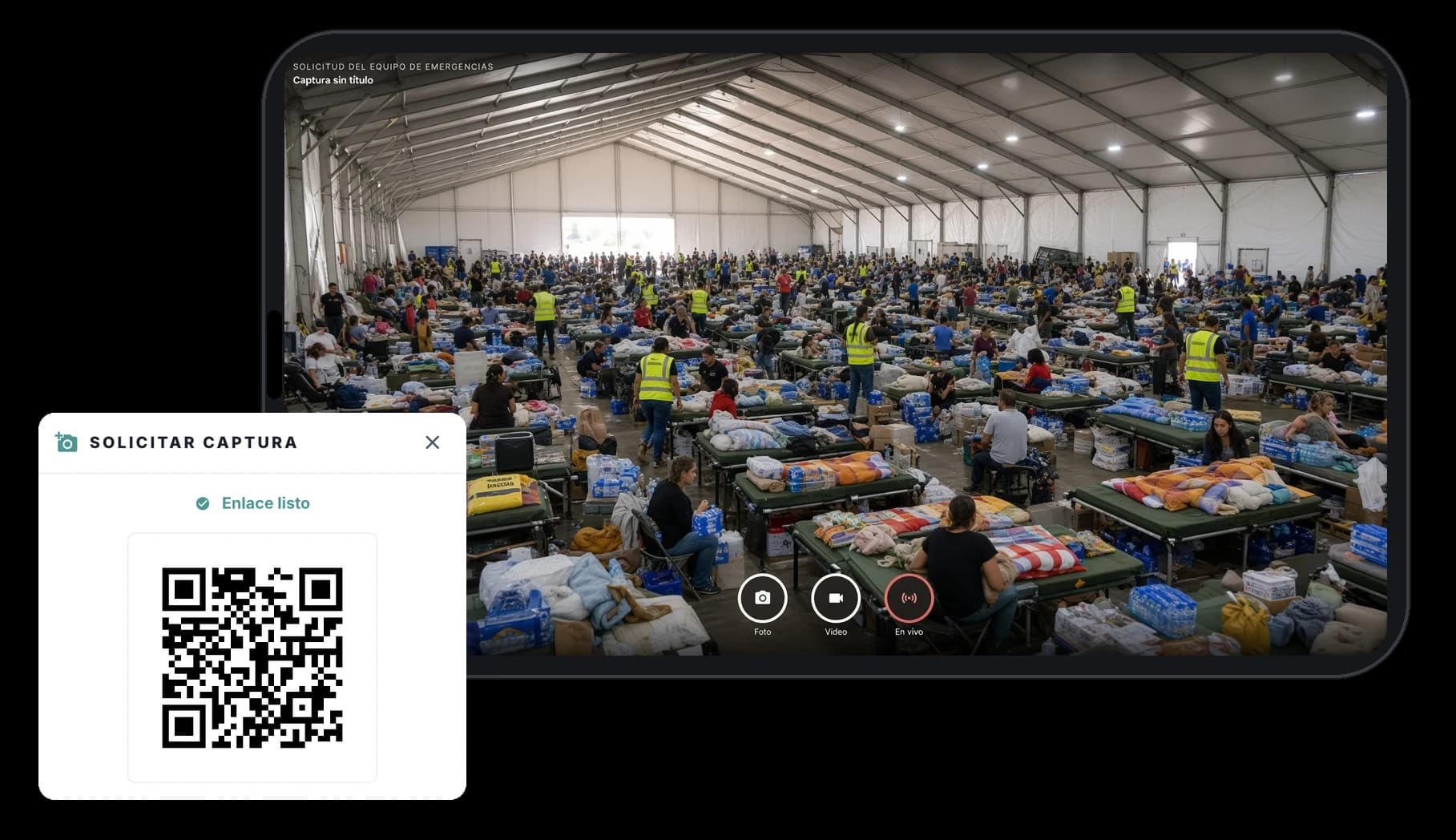
From the command centre, a link or QR code to request a capture is generated in seconds. The volunteer or field team opens it on their phone and sends photos, videos or even live video, which reach the council instantly and geolocated. Everyone on the ground becomes the command centre's eyes: more context, faster decisions and resources where they are really needed.
- App
Field app: the whole operation in your pocket, even without coverage
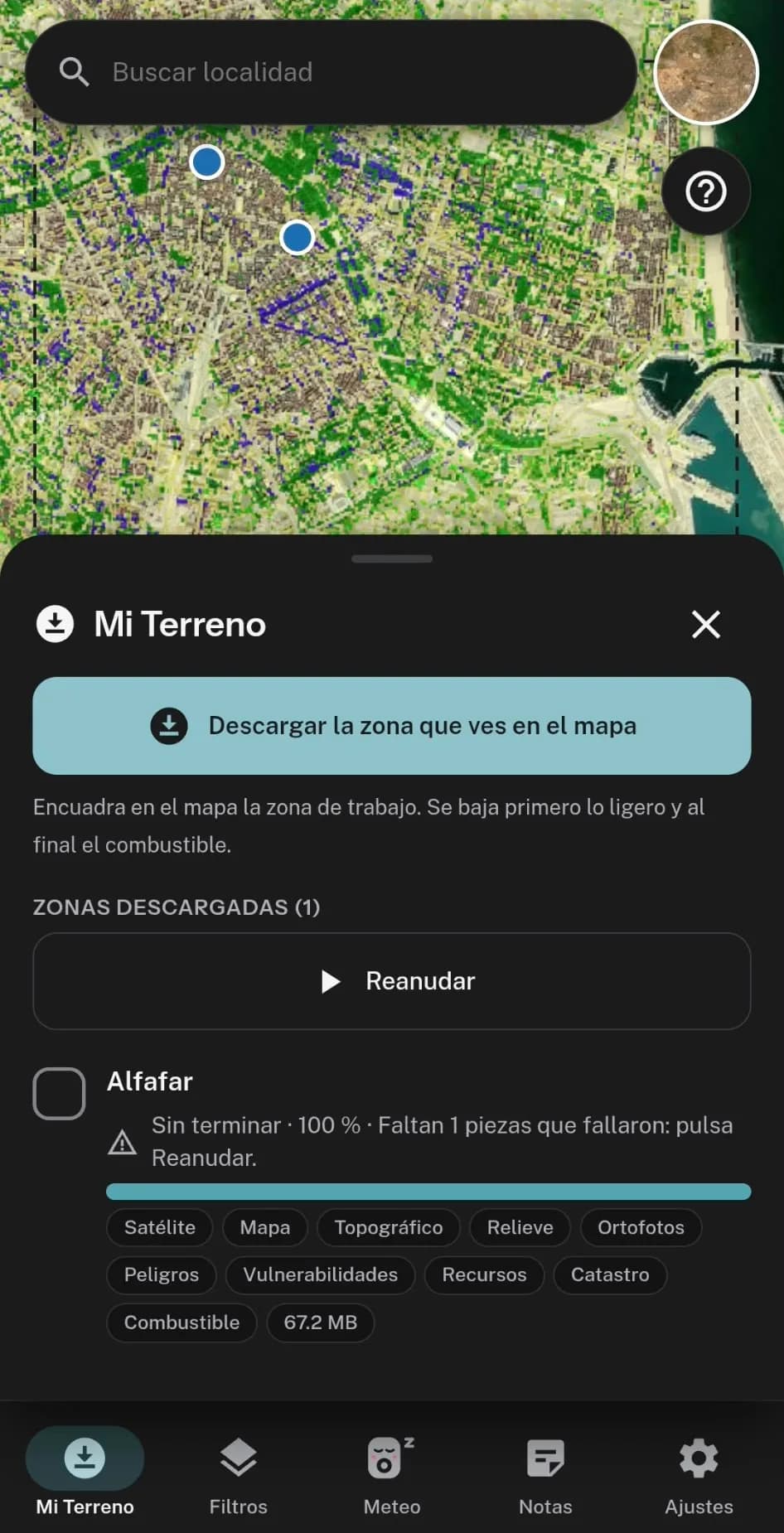
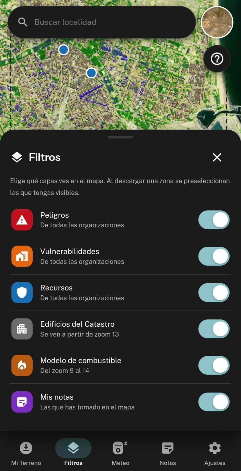
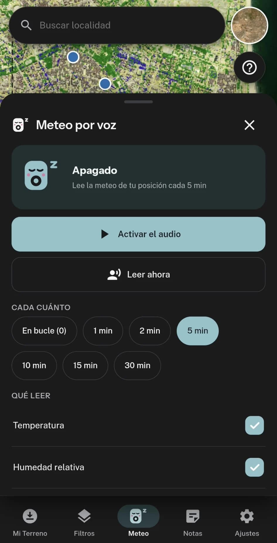
Built for people working on the ground. Before heading out, users download the fuel model map and all geolocated resources (hydrants, water points, access routes, vehicles), and the app works fully offline, right where coverage drops. When connected, it adds real-time weather and reads it aloud every few minutes, at the interval each user chooses: wind, humidity and temperature always up to date, hands free and eyes on the terrain.
- Web
- Mobile
Public emergency page
Throughout the emergency, the council publishes a public page that is always up to date: alert level, what to do now, official notices, road closures, area map, where to go, useful phone numbers and the emergency timeline. Residents check a single official source from any phone, with nothing to install, and rumours lose ground.
- Mobile
Citizen SOS: people in danger, located instantly
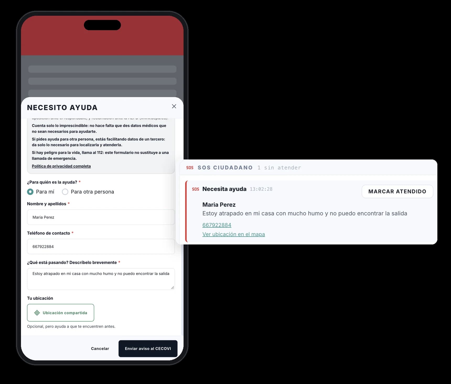
From the same public page, anyone can tap “I need help” and send an alert with their name, phone number, what is happening and their shared location. The alert reaches the Virtual Emergency Centre immediately, with the phone number one tap away and the position on the map, so the command team can prioritise and send help without losing a minute.
Frequently asked questions
What is the Virtual Emergency Centre?
Osprean's digital command post: the online version of the CECOPAL, where the whole team works with the same information in real time. Each person's access depends on their permission level.
How is the chain of command activated when an emergency starts?
Through the minute-zero sequence: Osprean contacts each person in charge by SMS and email in the defined order and escalates automatically if someone does not respond.
How does the public receive information?
Through a public emergency page, with clear instructions tailored to their location for as long as the emergency lasts.
Does the field app work offline?
Yes. The fuel map and geolocated resources are downloaded in advance and remain available without internet. When connected, the app adds real-time weather and can read it aloud every few minutes, at the interval the user chooses.
Get your municipality ready before the next season
Request a demo or a territorial preparedness assessment for your municipality.